| The "Archaeological Atlas of Palaepaphos"
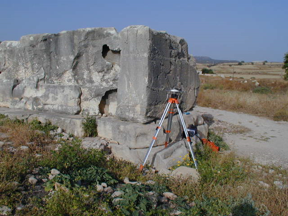
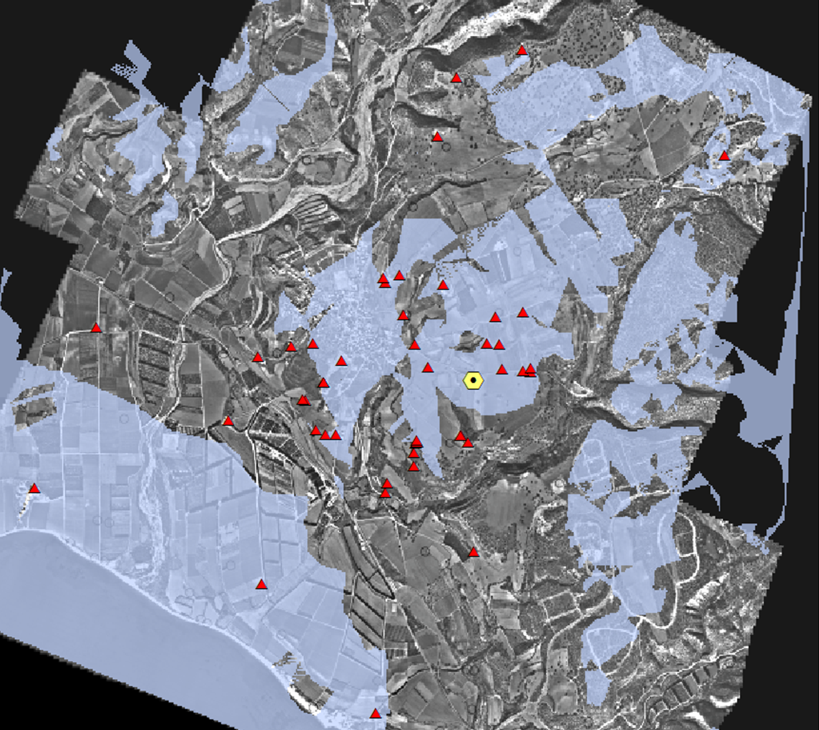
In 2002, the Archaeological Research Unit, of the University of Cyprus, in association with the Institute for Mediterranean Studies for the Foundation Research and Technology (FORTH) in Crete initiated a digitization programme for the recording of all archaeological evidence in the area of Kouklia. The project was largely benefited by the contribution of the Department of Lands and Surveys and the Department of Geological Survey of the Republic of Cyprus, who, among others, provided the orthophotomap of the Kouklia area and information regarding the geology of the area. The process of digitizing both visible (i.e. architectural remains) and non-visible (i.e. tombs) archaeological data was based on the application of Global Positioning System (GPS). This electronic platform, known as "The Archaeological Atlas of Palaepaphos" brings together archaeological information spanning over 5sq. m. around the Sanctuary at Palaepaphos. A preliminary GPS topographic survey was carried out in 2002 aiming towards the topographic registration of the surface monuments of the site. The topographic survey was carried out using 2 Ashtech CGRS GPS receivers (Z12) in stop-and-go mode measuring at the local geodetic system (WGS '84 / Local Tranverse Mercator System) of the Department of Land and Surveys, Republic of Cyprus. Based on the mapping of the surface monuments and the geomorphological settings of the site, a geophysical survey module was planned focusing on specific sections of the site. |
 |
 |
 |
 |
 |
|
Archaeological Atlas of Palaepaphos: Digital recording of sites at a diachronic level
|
|||
 |
 |
 |
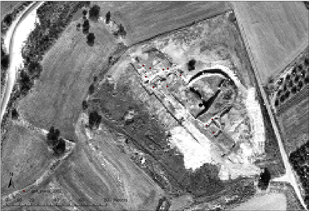 |
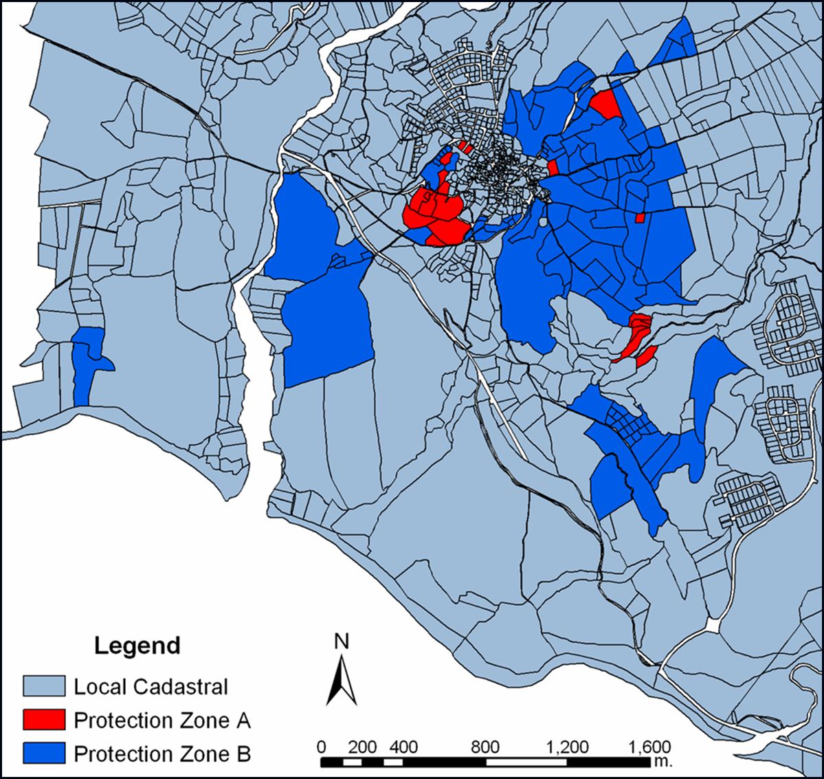
| Creation of digital maps | Visibility analysis (example from the site of Hadjiabdullah) | Digital map of Protection Zones A and B at Kouklia | GPS points taken at Marcello during the 2002 fieldwork |
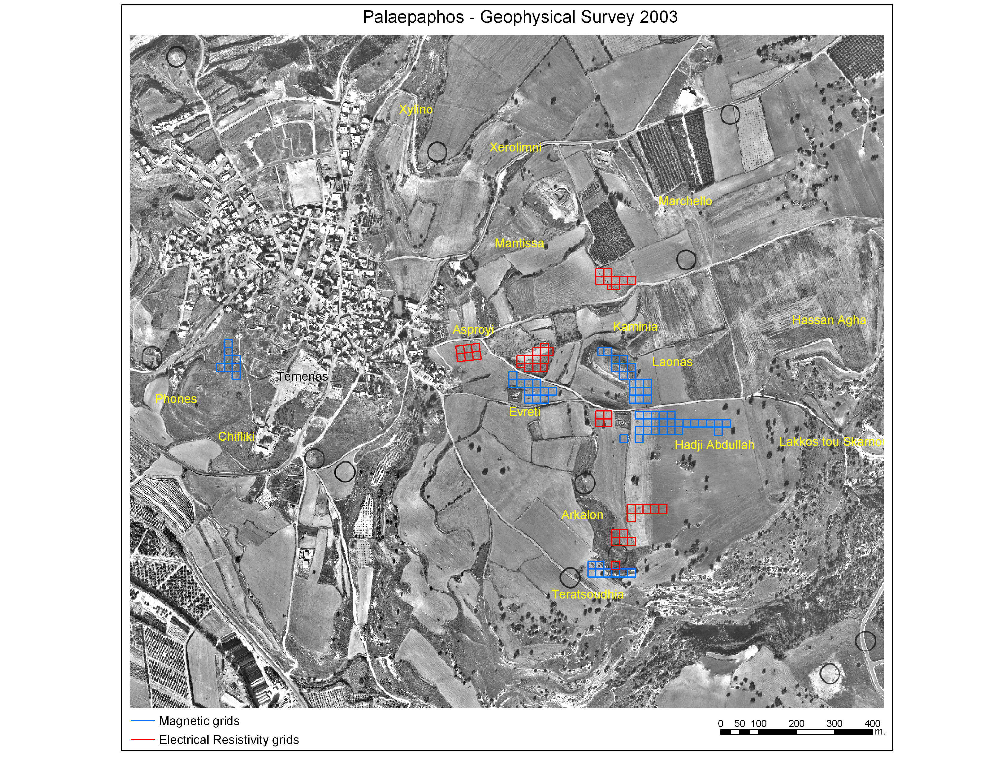
| Geophysical Surveys in 2003
Following the 2002 field-work, geophysical surveys, employing resistivity, magnetic and GPR techniques were initiated in 2003 (also in 2007 and 2010), by the Institute for Mediterranean Studies of the Foundation of Research and Technology (IMS-FORTH). They were directed by Dr Apostolos Sarris, Director of the Institute's Laboratory of Geophysical-Satellite Remote Sensing and Archeo-environment in collaboration with Maria Iacovou. The 2003 geophysical surveys were made possible thanks to the participation of Vasiliki Kassianidou and George Papasavvas of the Department of History and Archaeology of the University of Cyprus and the students Maria Dikomitou and Giorgos Papantoniou, in association with Apostolos Sarris and his team from the Institute of Mediterranean studies at Rethymnon. The 2003 geophysical survey covered 44.178 sq.m. A high degree of overlap existed among the different methodologies in order to enhance the interpretation of the data. All maps and the corresponding interpretation of the geophysical features have been registered to the GIS application of the Project. The aim of the 2003 geophysical survey was to locate the circuit of the city wall and supply the Department of Antiquities of Cyprus with evidence that would enable it to place the intra muros urban space under a significantly greater degree of protection. In the course of carrying out the geophysical survey there was no definitive indication that the section of the city wall that was assumed to extend from Marcello to Hadjiabdullah, and more importantly, that the landscape of the area presented significant peculiarities: the presumed external side of the wall, outside the urban space was always on higher ground, whereas the urban space assumed to be inside the wall was on lower ground. |
 |
| Geophysical surveys in 2003 | |
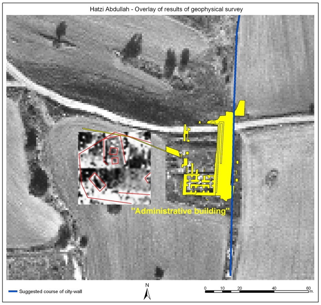 |
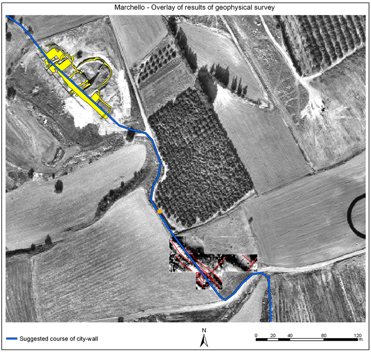 |
| West of the Hadjiabdullah monument | South-east of the Marcello monument |